Wellington Airport (WLG)
Orientation and Maps
(Wellington, New Zealand)
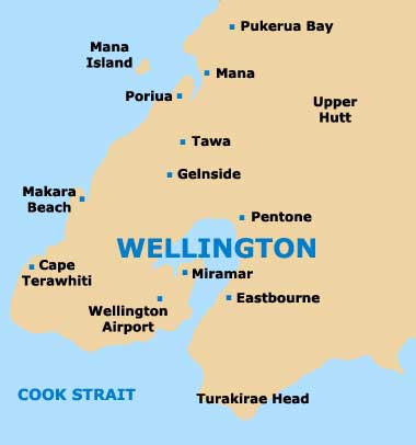
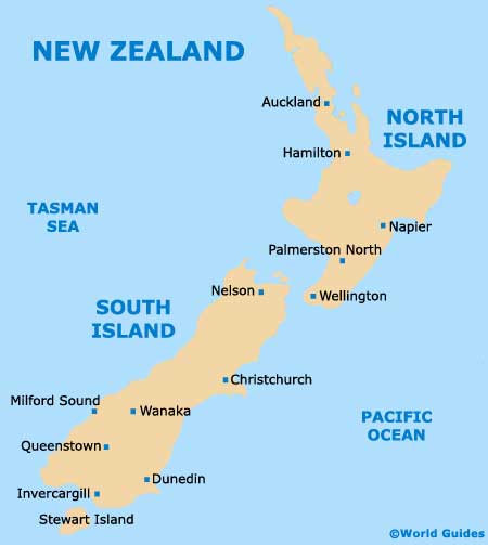
The country's vibrant capital city, Wellington is based around a particularly attractive harbour, lying on the most south-easterly tip of New Zealand's North Island. Directly north of Wellington, the Kapiti Coast contains a number of secluded beach attractions, with Kapiti Island being located off the shore.
On the south-eastern side of the city you will find Wellington International Airport (WLG), connected by Super Shuttles and local Stagecoach Flyer buses. Most buses arrive and depart at Courtenay Place in the centre of Wellington, close to Cambridge Terrace and the train station.
Wellington International Airport (WLG) Maps: Important City Districts
The main financial area of Wellington is centred around Lambton Quay, which stretches alongside the coastline, leading into the city centre. To the north, the Thorndon area is a particularly historic neighbourhood, with many fine buildings and impressive examples of Colonial architecture at its best.
Recently renovated and thoroughly revitalised, the Jervois Quay area has become a trendy part of Wellington, together with both Cable Street and the Oriental Parade. Many top restaurants are located in this region, as are a range of entertainment options and local shops.
The main tourist information centre is Wellington can be found on Civic Square and is open from Monday to Sunday. Further tourist offices are sited at the airport and on Lambton Quay, where leaflets, maps and magazines are all available.
New Zealand Map
Wellington Map