Wellington Airport (WLG)
Driving Directions / Travel by Car
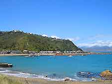
(Wellington, North Island, New Zealand NZ)
Close to the central downtown district and sited on the city's south-eastern outskirts, the busy Wellington Airport (WLG) can be reached along several routes, although the State Highway 1 is the quickest and most direct route.
The highway is made up of a number of roads, including Vivian Street, Mount Victoria Tunnel, Ruahine Street, Wellington Road, Cobham Drive and Calabar Road. Wellington Airport edges Evans Bay to the north and Lyall Bay to the south. Other nearby points of interest include Maupuia and Miramar to the north-east, Worser Bay, Seatoun Heights, Strathmore Park and Breaker Bay to the east, and Rongotai to the west.
Around the edge of Wellington Airport, Stewart Duff Drive borders the eastern side, running next to the popular Miramar Golf Course, while Moa Point Road, Tirangi, Salak Street and Troy Street all skirt the western side. Notable roads with the airport complex include Bridge Street, Cairns Street and Rongotai Road.
Directions to Wellington Airport (WLG) from Wellington city centre:
- Wellington Airport is located 8 km / 5 miles to the south-east of the city
- Major roads that travel to Wellington Airport include the State Highway 1, which leads to the Mount Victoria Tunnel through Evans Bay
- An alternative route from the city centre to WLG Airport is along Oriental Bay and Point Jerningham, which is slightly longer and much more scenic
- The journey lasts roughly 20 minutes
Wellington International Airport (WLG): Virtual Google Maps
